
To Find You
3D Visualization | Blender
Exhibited: Limburg Biennale (2024), Fresh Legs Exhibition (2024)
To Find You (2023-24) is an immersive 3D map that can be experienced with a VR headset. All videos and images are rendered from map built by collaging with data obtained from Google Earth.Map making has been used as a tool to create the demarcation, the imaginary border that embedded into the memories of citizens. This project is an inverse of that traditional map making, as it blends together urban scape from a large range of locations across the globe. To let this blur of the borderline be experienced, this map collage was turned into immersive VR experience, videos and postcards.Rendered images from the map were plugged into VPR(Visual Place Recognition) AI. The guessed locations and global coordinates given by the AI are then made into postcards. A little souvenirs from somewhere(or nowhere).
To Find You
3D Visualization | Blender
Exhibited: Limburg Biennale (2024), Fresh Legs Exhibition (2024)
To Find You (2023-24) is an immersive 3D map that can be experienced with a VR headset. All videos and images are rendered from map built by collaging with data obtained from Google Earth.Map making has been used as a tool to create the demarcation, the imaginary border that embedded into the memories of citizens. This project is an inverse of that traditional map making, as it blends together urban scape from a large range of locations across the globe. To let this blur of the borderline be experienced, this map collage was turned into immersive VR experience, videos and postcards.Rendered images from the map were plugged into VPR(Visual Place Recognition) AI. The guessed locations and global coordinates given by the AI are then made into postcards. A little souvenirs from somewhere(or nowhere).
To Find You
3D Visualization | Blender
Exhibited: Limburg Biennale (2024), Fresh Legs Exhibition (2024)
To Find You (2023-24) is an immersive 3D map that can be experienced with a VR headset. All videos and images are rendered from map built by collaging with data obtained from Google Earth.Map making has been used as a tool to create the demarcation, the imaginary border that embedded into the memories of citizens. This project is an inverse of that traditional map making, as it blends together urban scape from a large range of locations across the globe. To let this blur of the borderline be experienced, this map collage was turned into immersive VR experience, videos and postcards.Rendered images from the map were plugged into VPR(Visual Place Recognition) AI. The guessed locations and global coordinates given by the AI are then made into postcards. A little souvenirs from somewhere(or nowhere).

Cape Town, South Africa, -33.9248657,18.4239979
Cape Town, South Africa, -33.9248657,18.4239979

Hongkong, 22.3038254,114.1618652
Hongkong, 22.3038254,114.1618652

Iceland, 64.1591721,-20.5455627
Iceland, 64.1591721,-20.5455627

Morocco, 34.9231758,-4.3190622
Morocco, 34.9231758,-4.3190622
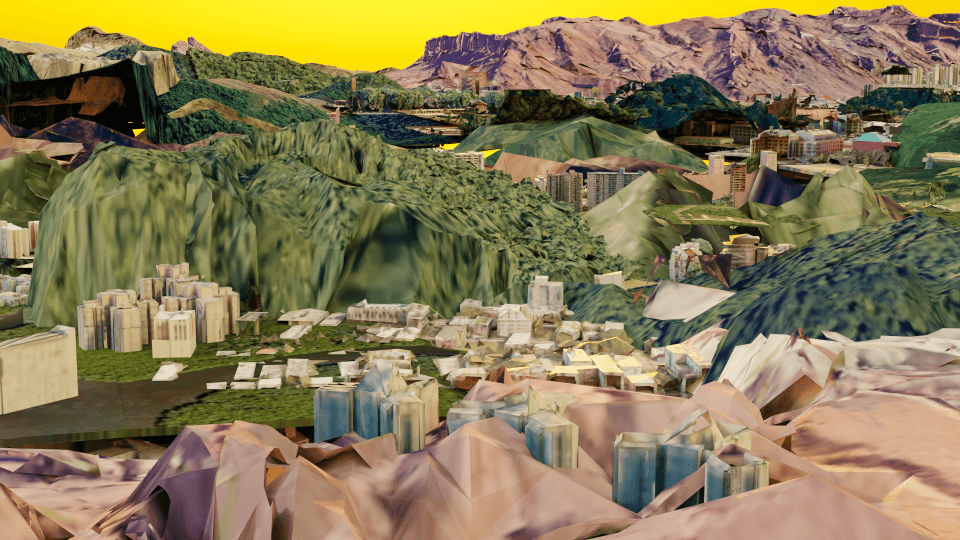
Portland, OR, 45.2834244,-122.6998291
Portland, OR, 45.2834244,-122.6998291

Santa Cruz Argentina, -46.6304741,-70.7228394
Santa Cruz Argentina, -46.6304741,-70.7228394